Archive for the ‘Exercise’ Category:

Patagona and Buenos Aires

March 22nd, 2014

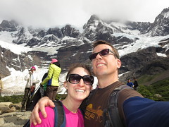
Just got back from the biggest trip I’ve done since my Round The World in 2007. Shayna and I spent over 2 weeks in South America, mostly to hike the mountains in southern Patagonia, but also to see glaciers and check out Buenos Aires. As you may or may not know, Patagonia refers the southern part of South America – both Chile and Argentina, covering mountains, lakes, and desert regions. Patagonia means “Big feet” – Spanish settlers apparently thought the natives had big feet. Some may call our trip a vacation, but if your definition of a vacation includes relation, pampering, and time to do whatever you want – this was not a vacation. It definitely was an adventure – and we enjoyed it tremendously.

Actual Itinerary (planned itinerary had more days in El Calafate area)
2/14 Fri ORD-GRU, Chicago – Brasil
2/15 Sat – stuck in Sao Paulo Airport, Brasil
2/16 Sun – GRU-EZE, Sao Paulo to Buenos Aires
2/16 Sun – AEP-FTE, Buenos Aires to El Calafate
2/17 Mon – Eco Camp 7-Day W-Trek Begins
2/24 Sun – Eco Camp 7-Day W-Trek Ends
2/25 Mon – El Calafate, Moreno Glacier
2/26 Tue – FTE-AEP – El Calafate to Buenos Aires
3/2 Sun – EZE-GRU-ORD Bye Bye Buones Aires
3/3 Monday, 6am, arrive back at Chicago O’Hare 

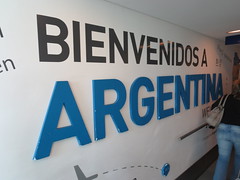
Our trip began on Valentine’s Day, Friday Feb 14, at 9pm by flying from Chicago to Buenos Aires through Sao Paulo, Brasil. We were supposed to only be in Brasil for a few hours (from 11:40am to 3:40pm), then spend saturday night in BA, then fly from BA to El Calafate on Sunday, then leave El Calafate Monday to begin our 7 day hiking trek in Patagonia. However, we ran into problems in Brasil. TAM, the airline in Brasil, said there was no room on the flight we booked 6 months earlier to BA. Of course this made us happy. But they found a spot on another flight later that night. Then when we were actually boarding the flight, they asked where our print out was of the Argentina reciprocity fee payment … we didn’t have it. Snafu part two. Glad they didn’t bother to ask us in the previous 7 hours we were at the airport. But its not hard to get – just go online, pay, and print. Of course there is like one printer shared amongst all the gates and wifi is soo slow its unusable. TAM did work with us and said they would print it once we paid. We went back to the United VIP lounge to use the wifi there (thank god for the VIP lounge), but we still missed the flight. TAM claimed that United in Chicago should not have let us board without it. Luckily, the United agent at Sao Paulo was extremely understanding and worked with us on getting to BA, as well as tracking our bags down. Between 1 and 2am, over 12 hours after arriving their, we had located the location of our bags (in Buenoes Aires EZE airport), confirmed a new flight to BA, and found a new flight from BA to El Calafate (since we were going to miss our previously planned flight to El Calafate). Also, you can’t purchase one-way tickets to/from El Calafate, so we had to leave El Calafate 2 days earlier than planned – meaning we had to remove El Chalten and Fitz Roy from our trip. The good news is that buying a brand new round trip flight last-minute costs almost the same as buying one a half-year ahead of time. Gotta love “emerging markets”.

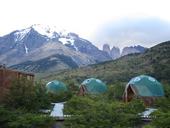
Once we arrived in El Calafate, I felt like the Patagonia trip began. We had booked a 7-day W-trek in Torres Del Paine with EcoCamp. I know I wanted to do the W-trek, which is like the most famous trek in Patagonia. Normally we love planning and doing everything ourselves, but we liked how Eco Camp was environmentally friendly, had good food, and would take care of all the details for us – neither Shayna nor I speak Spanish. The first and last day were just getting to/from the camp. So day 1, Monday, we left El Calafate, Argentina, at 7:30am, crossed the border into Chile around noon, and met the EcoCamp guide at the bus station in Puerto Natales, Chile. We signed things, had lunch, and headed north to Torres Del Paine. On the way we stopped at a park and learned about Milodon, an extinct native animal to southern Patagonia. We got to the camp, had happy hour, ate dinner, and slept in our luxiourious bed in a canvas dome. No, really, the bed actually was amazing, had plenty of comforters to keep us warm – no heat and got down to near freezing temps (still warm coming from Chicago where it had not been close to freezing in weeks).

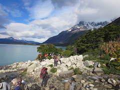
Tuesday, Day 2 of the 7-day trek was our first real day of hiking, roughly 11km (7miles) heading mostly west from Eco Camp (base camp elevation was around 150meters, or 450 feet above sea level). There were 12 of us that paid for this 7-day W-trek, 14 if you include the 2 guides. Each guide had 6 people – but after the first day or two we were just one big group. It was an easy day of hiking in terms of distance and terrain, but was the only day with bad weather – just cloudy, windy and light rain. We spent the night at our first “Refugio”, Refugio Cuernos (78m). Similar to US, backpackers are only allowed to sleep at designated areas in the park, the refugios. You can sleep in a tent or in dorm-style bunk beds. Thats where we stayed. It was packed, and got the late dinner shift. But thats ok, cuz they sold cold-ish beer, and the sun didn’t set till 9pm (summer down by the south pole). We played cards and walked around outside with some of our new Canadian friends. Food was not bad, but definitely not as good as the food at Eco-Camp.

Day 3 was one of my favorites of the trip – 23km (14 miles) in and out of the French Valley. We had a late start (3rd shift for breakfast), but had good weather. It took about 2 hours to hike 5km to Campamento Italiano. From there took another 2 hours to go 5km mostly north straight up the valley to our destination, the Mirador Britanico, aka Britanico Lookout. We had lunch on the way, and the whole way up was amazing views. West of us was the Glaciar del Frances (thats the French Glacier to you and me), and we heard several mini avalanches happening, but i only saw one from start to finish (it was far enough away that by the time you heard it and looked up, it was mostly done). After arriving at Campamento Italiano (170m) for the second time, we headed 7.5km southwest to Refugio Paine Grande (50m). This one was way better than the previous – more like a hotel. We still had dorm-style bunk beds and communal bathrooms, but we had huge cafeteria with good food, good company, great views, and refreshing beer and wine.

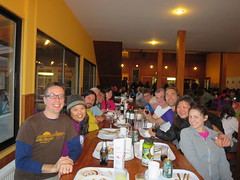
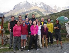
By the end of Day 3 we had made friends with everyone in our group. First there was the 2 guides, Nico (our guide), and Roberto. In our 6-person group there was Shayna and I representing Chicago, Rob and Laurie from Toronto, and Kyong and Marlene from Seattle. In Roberto’s group there was Petros and Lukas from NYC, Carlos and Laura from Mexico City, and Sharon and David from near Boston. Shayna and I were the youngest “couple” there, and Shayna was the youngest one except for the guides. Everybody spoke great English except the couple from Mexico City, who spoke good enough English. Everyone brought their A-Game to this trip. If they were tired you wouldn’t know it from their spirit, and talking on the trails and sharing dinner with everyone was one of the highlights of the trip.

Thursday, Day 4, involved a half day of hiking to the “Grey Glacier” followed by a boat ride and drive back to Eco Camp. It was 10.5km from Refugio Paine Grande to Refugio Grey, where awaited our boat journey. We hiked mostly north along Grey Lake, seeing little blue icebergs floating before we laid eyes on the big real glacier. Even though the lake and glacier were named “Grey”, the glacial ice was blue like most glacial ice. It’s blue because the immense pressure made the ice so dense that only the blue part of the light spectrum can pass all the way through. Although if you take a piece of blue ice and put it in your hands, it does not look blue any more, looks like regular ice. We had lunch at the refugio while waiting for our boat. Inside they had nice couches, hot cocoa, and beer and wine, of course. There was no dock for the boat, had to board via raft. The boat was big, and got close to the “Grey” glacier before zooming back south to let everyone off. The glacier was amazing, but I like Moreno Glacier more (details in El Calafate below). We got off the boat, walked to parking lot, took the standard 15-person Eco-Camp minivan back to basecamp where cocktail hour and dinner awaited.

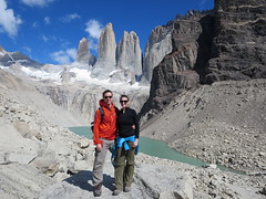
Friday, Day 5, was our last real day of hiking, but one of the best of the trips. We did 18km (11miles) total, to get to Base Las Torres (886m) to see Mirador Las Torres, or as I call it, the lake with a view of the three spires. We hiked 5km north up a valley to Refugio Chileno, which was similar to Refugio Cuernos in size. We didn’t stop long. The next stretch involved hiking right along the river as well as through forests and then at the end a bit of hopping boulder to boulder. But the end was definitely worth it – beautiful. We all took lots of pics, had lunch, and I got a quick nap in. Even though I was still low on sleep, I felt better than I had at any point on the trip. All that exercise and fresh air makes me come alive. On the way down Shayna and I stopped at Hotel Las Torres for wifi and a fresh beer. Beer always tastes best after hiking all day. And shayna needed to check her work emails. The hotel was much nicer than our eco camp, the dining room had giant windows facing north so guests can be in awe of the mountains. And they also had a releif map by the front desk that made it easy to visualize all the mountains and trails we covered the last few days. Glad we stopped in. Then we headed back to camp for shower before cocktails and dinner. Knowing we could finally sleep in the next day, i had a few after dinner drinks and hung out more with people in our group.

Days 6 and 7, the end of the trip, were less exciting, but still interesting. Saturday, Day 6, all 14 of us drove around and looked at the geology and animals. Chile protects the Guanaco, an animal native to patagonia similar to a deer. Well, Chile law forbids humans from killing the Guanaco, but not mountain lions, or Pumas as they prefer to call them. We saw several carcasses – apparently the mountain lion will kill, eat some, then take a few of the good bits back to the kids. They may come back in a day or so to get more. Vultures or other smaller animals might have a snack, too. We also got a little biking in – that was fun – but the bikes were a bit rusty and it was super windy – made it quite a challenge. The day ended early with the standard shower, cocktails, dinner. After dinner everyone had some drinks, told stories, and played Jenga. It was our last night and it was bittersweet. Ok, not really, but i always wanted to say an ending was bittersweet. We had gathered everyone’s emails and promised to share pictures. Day 7 was another early departure – had to leave at 6:30am to catch the bus back to El Calafate. There was a little concern that Marlene might not make it back into Argentina since she didn’t have the correct print out of her Reciprocity fee – but it all worked out.

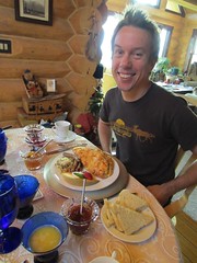
We arrived in El Calafate around 1pm on Sunday. Our hostel room was not great, but it was sunny and grassy out front and I laid down for an hour. That was very nice. Shayna did some work emails (she would spend at least an hour on her laptop each day for the rest of the trip. We also booked our glacier adventure for the next day – we decided to do the mini-hike on the glacier, which includes boat ride and bus. Then we wandered around town looking for dinner, ended up at an Italian-pizza joint (80% of all restaurants in argentina serve pizza or italian). Patagonia Lamb is supposed to be the best meat in the region, and as an avid lover of lamb, I was anxious to try it (never had lamb option in Chile). I wanted the Lamb stew special, but they were out, so I had lamb on my pizza instead. And it was sooo good. I also had a great local weisse beer. El Calafate is approved.

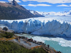
Monday was another one of my favorite days of the trip – seeing Porito Moreno Glacier. This was not my first time on a glacier – i walked around Franz Josef Glacier in New Zealand in 2007. But this one was visually much more impressive. Right up there with mountains as one of the most beautiful awe inspiring things on this planet. We had to pick up lots of people in Calafate, then 60ish of us made a bee-line to the boat, leaving the dock around 11am. We split into 3 groups, one english, two spanish, put on our ice cramp-ons, and climbed around the glacier for about 2 hours. At the end we had some scotch on the rocks, where the rocks where made fresh from glacier ice. Then off the glacier, off with the crampons, ate some lunch, and waited for the boat. On the other side we drove around to the parks main viewing center, and we had an hour to wonder around and see the glacier head-on. It was just so amazing. We were hoping that we’d get to see a big chunk of ice fall in the water, but no dice. Then we took the bus back to Calafate, where we had dinner at El Cucharon. I finally got my Lamb stew and it was deeelicous. Altho I might have enjoyed the lamb on the pizza a bit more. After dinner we did a little shopping and I bought Shayna a ring made from a local artist. Awwww.

Tuesday we had a flight to Buenos Aires later in the afternoon, so we killed time by going to Glaciarium. It’s a glaciar museum with a Ice Bar. We did both. The museum part was very well done, we covered it in one hour. perfect. Then we had a drink in -13 Glacio Bar. Back in Calafate we did some more shopping and headed to Airport. Our flight was uneventful and we arrived at our friend TJ’s apartment in the Palermo district of Buenos Aires. I tried to go out exploring but couldn’t figure out how to leave. Luckily we already ate and didn’t need anything. The next day i figure out that you have to touch the key fob to the special part of this metal box by the gate. Ok, i didn’t figure it out, somebody showed me.

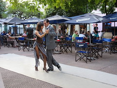
Wednesday through Saturday was mostly sightseeing in Buenos Aires. Highlights include the paid 1 hour tour of Teatro Colon, the Buenos Aires Opera House.   We didn’t make it to Mendoza, Argentina’s wine country, but enjoyed wine tasting with Anuva wines, followed by an amazing Italian dinner. We also got a free english guided tour of Recoleta Cemetery where Evita is buried, followed that with Lunch at La Biela, a famous outdoor cafe that comes with a clown playing an accordion.  We saw a professional Tango Show as well as Tango in the streets of  San Telmo.

We walked alot around down Buenos Aires – in awe of the grandeur and humbled by protestors, squeezed in some shopping, bought shoes for shayna, and pants and shirts for me.  And many delicious meals, including an amazing middle eastern joint called Sarkis, our favorite cafe, Sans, in Palermo Viejo, which was about 20 minute walk from TJ’s apt where we stayed.  Last but not least, we had to eat what Argentina’s famous for – great steaks.  We hit 2 parrillas – La Brigada and Don Julio.  We both like Don Julio better, probably because we had meat more like a filet mingon.

In conclusion I’d recommend Patagonia to everyone who likes the outdoors, loves  to travel, or wants something awe inspiring.  It’s up there with my favorite mountains in the world – others being Sierra Nevadas (Yosemite or Kings Canyon), Rocky Mountains (Glacier National Park), and Himalayas (Lamayuru Trek), and maybe the Swiss Alps.  However, if you are watching the wallet, skip the EcoCamp and plan the W-trek hike yourself.  Make sure you check out all my “Best of” pics, either on flickr or in my facebook album (assuming we’re connected). If you’re daring, you can check out all my pics on flickr (635 in patagonia, 143 in Buenos Aires). Note that we whittled those 800ish pics down from 2,000.   The next big trip is Alaska – shooting for summer 2015.

Kings Canyon: Goddard Canyon

June 18th, 2012

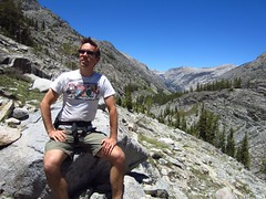
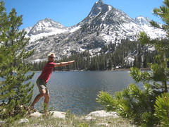
Got back last week from a very much needed backpacking trip in the California mountains.  I was out in SF for a conference, and decided to stay a bit longer to see old friends and get some time out in the mountains, enjoying nature, and being offline (for more reasons why i love backpacking, see my honeymoon post).  I was prepared to go solo, but was happy that my friend and old roomate Damian Spain could join me.  I chose Goddard Canyon because it had plenty of water along the route, the trailhead was in a national forest (easier to get permits vs national parks or wilderness preserves), had a ferry, hot springs, and a waterfall, several options for camping (campgrounds are * on key points) and was below 10,000 feet so we could have campfires. We planned for 5 days, but on the fourth day we decided to hike extra and drive home that night.  It was an amazing trip and would totally do it again.

Day 1:  Drove 4 hrs from SF to Prather, CA (got permit), 2.5 more hrs to trailhead at Florence Lake.  Hiked almost 8 miles to Muir Trail Ranch. Elevation from 0 to 7,700′

This was a busy day. We left SF at 7am, got permit around 11, had leisure lunch and drive to Florence lake, stopping by other dams and lakes, campgrounds, and ranger offices, arriving at the lake around 3.  The ferry was not operational for the season yet, so we had to hike 3.4 miles more than we planned, putting us around the private ranch around sunset.  We had trouble finding the campground by Blayney Hot Springs, so we just put up our tent along the jeep trail near the ranch. (Day 4 we found the campground, see below). If you arrive at night, another option would be to camp at one of the many car-camping campgrounds along the road about an hour from Florence lake. You can get a backcountry permit at a smaller High Sierra ranger office near Mono Hot Springs (map) the next morning, and have plenty of time to hike to the nice campground by the river and the hot springs.

Day 2: Hiked over 7 miles to the campground right passed the bridge 2 miles from the bridge marking Kings Canyon Boundary. Elevation from 7,700′ to 8,700′

This was a much easier day then the previous day.  We stopped because the campground was so nice – part shade, part sun, nice campfire ring,  plenty of wood, 50 yards from river and a little off trail (but still very visible to hikers).  One of the more interesting moments of the trip was when i stopped to fill up water in a small stagnant lake – a few leeches got on my water filter.  There were always tons of large black ants around, so i decided to give the ants some lunch.  Upon arriving at the campsite we took a nap and had a late afternoon campfire.

Day 3: Dayhike – Hiked about 10 miles up Goddard Canyon to see the falls, turned around before hitting Hell For Sure Pass.  Elevation 8,700′ to 9,700′ back to 8,700′.

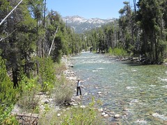
This was another easy day, we did it without packs and returned to the same campsite.  Goddard Canyon was similar to what we had seen so far, just more granite and a more narrow canyon.  The river was also a bit more interesting, having 5-10 feet granite walls in several places.  The falls were impressive, but next time I’d like to try going up Evolution Canyon instead.

Day 4: Hiked 16-ish miles back to car.  Elevation 8,700′ to 7,326′ (Florence Lake), drive back to SF.

By this point we had acclimated well to the elevation, so hiking was easy.  We made it from our campsite to Blayney Hot Springs campsite by lunch time (over 7 miles).  As it turns out, the campsite is right by the river, about a half mile from the main trail (just follow signs to Blayney Hot Springs).  We found campfire rings but could not find the hot springs – later we figured out you must cross the river to the hot springs which lie in the meadow.  At lunch we decided to cut the trip short and hike all the way back to the car and drive home.  Damian said he had to be back to try on some dresses (or something like that).  I actually had a blister on the bottom of my left foot so I was also down to finish off hike.  We had an amazing time up to that point and I was completely satisfied.  On the way home we stopped in Fresno for enchiladas, only Damian was too tired to read the entire menu and got something else instead.  We arrived in SF about 2am thanks to D’s mad driving skills.

In summary we hiked about 40 miles, drove 13 hours, saw beautiful mountains, lakes, amazing trees, and animals, had time to relax, play with fire, get lots of exercise and fresh air, and had that reset button pushed hard.   Can’t wait to make it to the Sierra Mountains again.

Honeymooniversary

August 15th, 2011

Shayna and I just got back from one of the best trips I’ve ever had – spending 10 days in the beautiful mountains of Glacier National Park, Montana, where we celebrated the one year anniversary of our wedding honeymoon.  The trip was awesome on so many levels, including the camping, hiking, and majestic views, but mostly it was great to spend quality time with the wife in the great outdoors. I highly recommend everyone to go, whether you stay in hotels or in tents, glaciers or not. I cover more on the trip below, but first here’s why it’s awesome:

Why I love Backpacking

  • Being surrounded by nature
  • Tons of exercise
  • Tons of sleep
  • Campfires (and s’mores)
  • Spending quality time with fellow backpackers
  • Getting away from it all (people, technology, normal life)
  • Everything you need is on your back or found in nature
  • Food tastes awesome when you’re burning 2-3 times the usual amount of calories
  • Re-appreciating how great showers, beds, and other comforts are when finished

Why I love Glacier National Park

  • The view – mountains, glaciers, lakes
  • The smells – fresh pine, cedar, sweet flowers, smokey campfires
  • The hikes – Favs are Highline Trail and hike to Ptarmigan Tunnel
  • The temperature – Hot enough to go swimming, but cool at night

When we first arrived at the airport, we got our rental car and drove to the town of Kalispel, the largest of many small towns in Flathead valley, just west of the park.  We stopped by a famous house, the Conrad Mansion, barely catching the last tour of the day.  It  was an impressive house and an interesting tour – built over a hundred years ago and restored to its original condition (we took many pics of this).  From there we drove to the hills to our first Bed and Breakfast, The Garrison Inn.  Our hosts Gene and Anne Marie were very nice.  Gene is also a professional chef and made us a delicious dinner and an amazing breakfast – probably the best omelete I’ve ever had (insanely fluffy, almost a quiche).

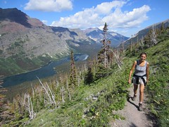
After the B&B we drove about an hour before entering the park.  We debated white water rafting and horse back riding, but decided water was too cold and horses were not my favorite.  We got lucky and found a spot in the Apgar campground, had lunch, then went for our first real hike to the Apgar Lookout.  The next day we moved a bit further east, getting a spot at Sprague Creek campground.  That day we did one of our longest and most beautiful hikes – Highline trail from Logan Pass to Granite Park Chalet, then on down to our car at The Loop, about 12 miles total.   We saw our first big animals – mountain goats.  Did you know they have bacteria in their stomach that generates heat?  That helps them survive the mountain tops during 40 below winters.  That night we slept super solid – 7 hours of hiking will do that to ya.  The next day I gorged on the breakfeast buffet at the lodge (totally worth it), then we drove over the to east side on Going to the Sun road, which was supposed to be awesome but all the road construction made the experience a bit annoying.  That night we stayed at St. Mary campground and were lucky enough to catch a performance by the Blackfeet tribe, the native americans who live east of the park.  They explained their music, competition dances, and costumes in great detail.  Big props to traditional Native Americans.  Afterwards we had our first campfire.  I love fires.

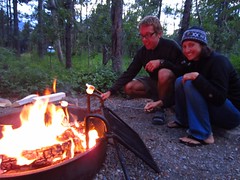
The next day we got up super early (6:30am) to get to Many Glacier campground to ensure we get a spot.  It’s the most popular campground in the park, and, like all but 2 campgrounds, takes no reservations – first come, first serve.  All spots are snatched up by around 8am-8:30am every day.  After securing our spot, we took the day off from hiking and explored the Many Glacier Lodge and surrounding areas (the great lodges are amazing).  I also explored my book and the back of my eyelids in the afternoon (gotta have naps on vacation, right?).  We had a camping stove issue that was resolved the night before (oh, thats how you clean it) and this was the first day we had hot meals from the stove.  Previously we snacked on bars, PB, fruit, nuts, broccoli and hummus, bread, cheese, crackers, and pickles, which were all good. Now we had hot oatmeal and other warm dishes like rice and beans and indian food. We saved the freeze-dried for backpacking. Our second day at Many Glacier we hiked to Iceberg lake. We wanted to hit up  Grinnell glacier, but that was closed due to bears.  So guess what we saw about 150 yards off the trail to Iceberg lake?  A grizzly bear and her 3 cubs.  Awesome.  We also saw a mama moose and her baby – from only a few feet away as they were on the trail.  The last day at many glacier was more chilling out, shayna did a short hike and I did some picture/laptop stuff.  That evening we had our first rain storm and were lucky enough to be able to watch it from the lodge.  Later after that we had another campfire along with s’mores.  Mmm-mm.

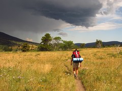
Saturday morning we left Many Glacier to start our backpacking adventure.  We drove to the Chief Mountain Trailhead, which is right next to the Canadian border, to enter the Belly river area of the park.  It was about 10am when we began backpacking, a mostly level hike 13 miles to our first camp at Glenn’s Lake Head.  Let me reiterate how unbelievably beautiful this park is.  Gorgeous natural diversity, from moutains, glaciers, snow, streams and lakes, to fields of grass and flowers, to rocky and dusty mountain tops, to pine and aspen forests, and more .. sometimes all at once.  The highline trail gave us a taste but being surrounded by nothing but pure nature takes it to the next level.  The next 2 nights we spent at Elizabeth Lake head campground (i say head since the bigger lakes have 2 campgrounds, one at the head where water comes in, and one at the foot where water exits).  Each night we had to store all our food, toiletries, even water in bear bags and hang them high up in the trees.  We also had to prep food and eat in common areas. It was a nice way to meet people – we met boy scouts, families, and several couples .. but not the most romantic.  Except the first night, where we had a campfire and more s’mores, we crashed pretty early – often before dark.  Once shayna was down for almost 12 hours, after hiking probably the most scenic hike on the trip, up to Ptarmigan tunnel.  It was 12 miles roundtrip, over half a mile vertical, with the most diversity and impressive views of any of our hikes.  It was tough, but thats how we like it.  Gotta earn it.  Other adventures included discovering amazing waterfalls, fording rivers, and dealing with hail storm on the last day hiking out.  The last 2 nights of our trip were just us appreciating showers, beds, nice meals, and relaxing.  It went by much too quick.

This trip was definitely a backpacking and camping trip first, and honeymoon anniversary second. I say honeymoon anniversary since this trip, being a backpacking trip, was more similar to our honeymoon backpacking adventure on Isle Royale (more deets) than our wedding  That said, wife and I had an amazing time together.  I feel so lucky to have a girl who is into backpacking almost as much as I am, even though she’s only been on 3 real backpacking trips! We both hope to do at least one major trip a year from now on.  So stay tuned for more adventures.

Indiana Dunes Camping

May 28th, 2009

Last weekend we spent a couple nights camping at the Indiana Dunes, about 90 minutes from Chicago.  It was awesome – the first time I’ve gone camping this year.  Despite it being Memorial Day weekend, it wasn’t too crowded – we snagged a walk-in camping spot friday morning at 10am, which is check-out time.  We chose Dunewood Campground in the National Park over the state park cuz Dunewood was surrounded by trees (and we like the yelp info). The state park is closer to the lake and has RV hookups .. but no trees and you’re basically right next to your neighbor.

The dunes themselves were pretty cool, but mostly it was just a big beach, unlike Pismo Beach in California which is more like a desert going back a mile from the water.  Friday we climbed to the top of Mt Baldy (second highest spot in the area) and watched the sunset, then ate dinner back at the campsite.  Saturday we walked around the Chellberg Farm and Bailly homestead – Joe Bailley was the first in the area in 1822 and traded furs with the native americans.  They had some restored homes and structures that were pretty interesting.  In the afternoon we went to the state park and had lunch, played frisbee, and hung out.  It was warm enough to enjoy the beach but not the water.  Apparently Lake Michigan can have very high bacterial counts – you don’t want to go in the water when that happens. Saturday night we played cards, played with the fire, and ate lots of smores.  Could not have been more relaxing.

Now that we’ve been to Starved Rock and Indiana Dunes –  I want to go camping at Devil’s Lake – do some swimming, hiking, and campfires.  My favorites.  See more on chicago camping.

Marathon Done

August 28th, 2008

Finish Line Fun

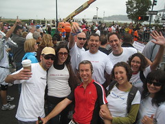
Just a quick note saying … Done. I accomplished my goal, finishing the San Francisco Marathon on Sunday, August 3. Shayna surprised me at the finish with a bunch of my friends, snacks, and beer. What more can a boy want? We ended up hitting Zeitgeist for the rest of the afternoon.

SF Marathon via chad's GPS

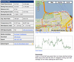
I was sad that my body gave out on me – after running for 17 miles, my knees stopped working, to the point where when i run i would fall. So the last 9 miles or so i walked. My training was good – I never got tired, i guess i have to admit i’m not 18 and indestructible anymore. And since then, I haven’t been able to run more than 6 miles without my knees hurting again. Time to get back into biking …

20 Miles

June 18th, 2008

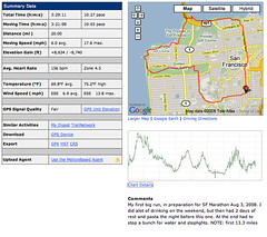
Today I did my first big run in preparation for Aug 3. I ran 20 miles in 3.5 hours. I know, I can’t beleive it myself. I’ve been serious about the SF marathon ever since I’d signed up, but today was the first milestone proving I’m doing it. And right before my 10 day trip to Jamaica .. Ahhhh yeah …

mb_6021569-First_Big_Run-2008_06_18

For the running geeks out there, I ran this like I do all my runs – with my GPS Forerunner 305 watch and heart rate monitor. I love uploading my runs to motionbased.com as well as looking at them on google maps. I also wear headphones and listen to my iPhone (like my iPod, only i can take pics and view google maps if need be). I must confess my GPS watch said 19.2 miles when i stopped it, but Garmin software on the ol’ computer says 20miles. Breaks down like this – I ran solid the first 7.5 miles to the Beach Chalet, where Golden Gate Park hits the Ocean, and went inside for a drink of water. Then I ran solid up to and through the Presidio to Sports Basement, where i took my second break at 13.4 miles (135 mins), drinking more water and having my only snack, a Cliff Shot of goo. Then I ran through the marina and down Van Ness, at which point traffic, people, and stop lights disrupted my flow. I never realized how much work it takes to run, stop, run, stop, etc. Also had to buy a bottle of water cuz i was so thirsty. I got home and was not tired, but my legs ached, and had a blister on my foot. Not bad.  I also give props to eating pasta the night before and no runs for 3 days.  Mr. Marathon, I am READY.

Solo Backpacking

June 16th, 2008

I’ve been wanting to do a Backpacking trip by myself for some time. And after Otto’s Passing, I really needed it. I wanted to do 3-5 days, enough time to get out there, let the dust settle in my brain so i had time to think, reflect, or just relax. I also needed some good exercise, different than my constant running. So off I went …

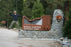
Chad entering Kings Canyon National Park

On Tuesday, June 3, I packed up, voted, then left San Francisco for the Sierra Nevada Mountains. At first I wasn’t sure where to go .. I considered Yosemite, Tahoe, .. but went for Kings Canyon. I did a day hike there in 2006, as well as a Backpacking trip near there at Jennie Wilderness with Juan and Damian in 2004, so i knew what to expect. I got there a few hours before sunset, enough time to eat, setup camp, and walk around a bit before bed.

Wednesday I got early and went to the Lodge to find trail info from some backpacking books. I took a few pics of some good hikes, then went to Roads End to get my wilderness permit. The rangers warned that there was still lots of snow .. mostly above 9,000 feet. I considered doing Paradise Valley (start of Rae Lakes Loop), but ended up picking Bubbs Creek to Junction Meadow, with a day hike option to East Lake or Charlotte Lake.

I started hiking around 10:30am Wednesday at Roads End (Elevation 5085 ft). It was 2 miles through the valley floor to my first Junction, then I crossed Bailey Bridge up Bubbs Creek, hitting switchbacks out of the valley to Sphinx Creek Campsite (6280 ft), my first rest, about 4 miles in. As soon as I took my backpack off, I brilliantly twisted my ankle. I hurt like hell at first, but turned out mostly OK .. wasn’t able to use it fully for over a week. After water refill and a snack, i continued on to Charlotte Creek. It was 4pm when I stopped, and my GPS watch said i hiked over 7 miles. I wasn’t sure if i had 3 or 5 miles more till Junction meadow (depending on if you trust books, maps, or trail signs), so I decided to camp, since 5 miles more would be too much. I setup tent, got water, cooked dinner – delicious spicy chicken with rice and vegies, and appreciated clean air and sunset. I was wiped out, and was in bed asleep around 9pm.

Preparing for Swim

Thursday I woke up 6ish, got out of the tent at 7am, packed and hit the trail by 8. Charlotte Creek (7280 ft) was overflowing, and I had to crawl over wet slippery logs to cross .. my first semi-dangerous adventure. I made it to Junction meadow (8190 ft) around 10am .. so it wasn’t that far after all (about 3 miles according to GPS watch). I decided to setup camp, have brunch, and do a day hike. After some tasty oatmeal, orange and banana, I hit the trail by noon. The rangers warned that bubbs creek would be too high to cross to east lake, but i ran into another hiker (first person I met on the trail) who just came from there – he spent the night on top of snow at Lake Reflection, a few miles past east lake. On his suggestion, i went to east lake instead of Charlotte Lake – mainly cuz it was closer and I’d like to spend some time swimming and exploring the lake. Bubbs creek was super high and I ended up crossing water 4 times, mostly over fallen trees, but the last crossing involved some jumping and getting my feet wet. I ringed out my socks, put my boots back on and kept on. I climbed out of the junction valley up east creek to the most beautiful views (video). I made it to East lake (9475 ft) around 2:30, swam, ate, and sunbathed till 4pm. Happy and fully rested, I hiked back down, getting back to camp by 5:30 (crossing the rivers again without falling in this time). I could feel the elevation but felt great after the afternoon at the lake. My stove wasn’t working, so i got a fire going and boiled water for my beef stronganoff (not as good as the spicy chicken). After eating I basically played with fire till after dark, and was asleep by 10pm. There were 3 other groups at junction meadow, from 2-4 peeps each.

Friday i didn’t get out of the tent till 8ish, had a leisure breakfast and wrote in my journal till 11. I then busted out of there, thinking i had to return my bear cannister before the ranger station closed at 3pm. It took me about 3.5 hours to hike out, arrived at 3:10pm – rangers were gone but they had a drop-off for the bear cannister. I was beat. I took off my boots and it was awesome – they were still pretty new and rubbing me raw in weird places. I grabbed a beer at the lodge and hit the road back to SF around 4pm. I stopped at In-N-Out and had the most delicious burger and fries ever. I made it home by 9, and went out to Amnesia for some brasstax action. Yay.

In Summary, I hiked about 30 miles over 3 days with about 4,400 feet elevation gain. You can check out my hike info from GPS Watch (it shows just the going up part, batteries ran out at east lake). Also view the Google map of the hike. At some point I want to do Rae Lakes Loop Hike, a 4-7 day trip. It is supposed to be so Amazing, one of the best in the Sierras. Here’s a sample itinerary.

Weight, Obesity, and BMI

April 25th, 2008

Did you know 1 out of 3 Americans is obese? 2 out of 3 are overweight? Yep, according to a 2007 CDC study. And according to a 2007 worldwide study, 40% of adults are overweight, with 25% being obese. Holy crap. More people are obese than underweight worldwide (WHO 2000). And don’t forget the childrens – 15% of those ages 6-19 are overweight according to 2000 CDC data, triple what it was in 1980 (more stats).

But how much do you have to weigh to be considered obese? Well, you are considered obese if you have a BMI greater than 30, and overweight if its greater than 25.

What is BMI? Body Mass Index. It’s the most popular, accurate way (heh, way, pun) to measure obesity (sort of). It’s a simple formula based on your weight (lbs or kg) and height (inches or meters). According to CDC, the BMI formula is 703 x (lbs) / (inches^2), or if you are from metric land, its just weight (kg) / [height (m)]2. For me, I have a 23.7 BMI, thats 703 x 175 lbs / (72 inches)^2 = 23.7, or 79.4 kg / (1.83 meters)^2 = 23.7 in metric talk. Heres my BMI results from this BMI Calculator, which gives you a nice chart like this:

BMI Weight Range (6′ tall) Weight Status
18.4 and Below 135.7 lbs and Below Underweight
18.5 – 24.9 136.4 – 183.6 lbs Normal
25.0 – 29.9 184.4 – 220.5 lbs Overweight
30.0 – 34.9 221.2 – 257.4 lbs Obese (moderate)
35.0 – 39.9 258.1 – 294.2 lbs Obese (severe)
40.0 and Above 295.0 lbs and Above Obese (very severe)

If you’re 20 years or older, its the same for men and women. Here’s a BMI Calculator for those under 20. If you ain’t feeling this math or the BMI thing, don’t worry – I crunched the numbers and made this reference chart.


Weight Chart, Over 20 years old

Height Normal Weight Range Obese
5 ft, 0 inches 94.7 – 127.7 lbs 153.3 or more
5 ft, 1 inches 97.9 – 132.0 lbs 158.5 or more
5 ft, 2 inches 101.1 – 136.4 lbs 163.7 or more
5 ft, 3 inches 104.4 – 140.8 lbs 169.0 or more
5 ft, 4 inches 107.7 – 145.3 lbs 174.5 or more
5 ft, 5 inches 111.1 – 149.9 lbs 179.9 or more
5 ft, 6 inches 114.6 – 154.5 lbs 185.5 or more
5 ft, 7 inches 118.1 – 159.3 lbs 191.2 or more
5 ft, 8 inches 121.6 – 164.1 lbs 196.9 or more
5 ft, 9 inches 125.2 – 168.9 lbs 202.8 or more
5 ft, 10 inches 128.9 – 173.8 lbs 208.7 or more
5 ft, 11 inches 132.6 – 178.9 lbs 214.7 or more
6 ft, 0 inches 136.4 – 183.9 lbs 220.8 or more
6 ft, 1 inches 140.2 – 189.1 lbs 227.0 or more
6 ft, 2 inches 144.1 – 194.3 lbs 233.2 or more
6 ft, 3 inches 148.0 – 199.6 lbs 239.6 or more
6 ft, 4 inches 152.0 – 204.9 lbs 246.0 or more
6 ft, 5 inches 156.0 – 210.4 lbs 252.5 or more
6 ft, 6 inches 160.1 – 215.9 lbs 259.1 or more
6 ft, 7 inches 164.2 – 221.4 lbs 265.8 or more
6 ft, 8 inches 168.4 – 227.1 lbs 272.6 or more

Notes:

I’m not sure I trust CDC entirely. This 2006 CDC study said no change in American obesity since 2003-2004. But by their own numbers, obesity went up 2% overall, almost a 7% increase (males up 7.1% from 31.1% to 33.3%, females up 6.3% from 33.2% to 35.3%). At that rate the number of obese people will more than double in 11 years. Yes, no-increase means double in 11 years. Hello? Is this the new Bush-Era Science?

SF Marathon

April 7th, 2008

San Francisco Marathon Course Map, 2008

I just signed up for my first marathon – the San Francisco Marathon on Sunday, August 3, 2008. It seems only appropriate to run my first in my favorite city ever. I’m not sure how much real training I’ll do – I ran a half-marathon over thanksgiving, and that went well. So i figure i’ll stick to my hour runs 3 times a week, using my gps watch and heart monitor, with the occasional long run every now and then. If anybody else out there is running it, lemme know !!

GPS Hike to Sykes Hot Springs

February 19th, 2008

Last weekend Shayna and I joined Terry and Dana on a backpacking and camping trip to Sykes Hot Springs. It was awesome. I’ve done many day hikes and overnight backpacking trips and this was one of my favorites. Not too far a drive from SF, the trail was part dusty, part lush forests, had views of the ocean and beautiful mountains. The first day ended with us arriving at a clear, refreshing river winding through camp (altho it was cold) and nice warm campfire after dark. The next day we slept in, had breakfast, soaked in the hot springs for an hour, and hit the trail back home. It was totally fun to do all this with another couple, especially Dana and Terry.

Team is Ready To Start

We decided to go last minute – Dana mentioned they were going on friday night, and saturday we thought about it, wondering if it was going to be too cold (it is February), and if we were allowed to have campfires (California is sensitive to them fires). After an hour of research, Shayna just said – if we’re thinking about it so much, lets just go!! And we did. After playing a little bit in Golden Gate park we went home, packed, and drove down to Monterey. All the cheap hotels were booked, we ended up staying in Seaside, just north of Monterey, for $100. Not so cheap .. but it was President’s day weekend. The next morning we got up, got some coffee, breakfast and sandwiches and hit the roads. We got to the ranger station about 9:15am. We were trying to hike with Terry and Dana, but they weren’t sure when they’d be able to make it. As it turned out, they showed up at the ranger station right after we did. Hurray.

We started the hike at the Big Sur Station, about 30 miles south of Monterey or 2.5 hours south of SF. We hiked the 10 miles in with our camping gear and food to Sykes campground, the fourth camping area along Pine Ridge Trail. Along the hike we stopped for beautiful views, pack adjustments, snacks, and pictures. By the time we got to camp we only had an hour of sunlight left and it was pretty crowded – we had to run around to find a decent camping spot. We setup our tents and it was getting too dark so we waited till the next morning to do the hot springs. Terry got the fire going and we basically hung out by the fire eating, drinking, and puffin’ till bed. We slept in, had some breakfast, another fire, packed up, and hit the hot springs on the way out. Our campsite was on the right bank of the river, and the trail and hot springs were on the left bank, so just like the previous day we had to wade across the freezing Big Sur River – it was as deep as a couple feet in some spots. And if you’re barefoot, you can’t run across the riverbed rocks like I did. Heh.

Sykes Hot Springs Tub

The Sykes Hot Springs were nice, but not that nice. I’ve read several reviews of them online (mark verber’s excellent details, 2004 NY Times , brian’s blog, yelp) but let me set the record straight as of February 2008, when we went. There were 3 hot tubs – each had man-made walls and varying sizes. There were 2 by the river, and a third one uphill from the one that was more downstream. That third one uphill was the biggest and the one we soaked in. It could hold 6 strangers or 10-12 close friends. The one downhill from that could hold 4-7 people, and the one upstream from that could hold about 2-5 people. You can smell sulfur in the air and there is a little bit of algae/dirt in the tubs. When we arrived at camp on Sunday they were all full, and the clothing optional rule was in effect. But as I said it was getting dark so we didn’t go in. On Monday morning we jumped in the only one that had room – the one uphill – it had just 2 UCSC girls in it at the time. The temperature was nice, the reported 100-degrees seemed about right. That’s not as hot as most hot tubs which are more like 104, but hot enough to ease them sore muscles. The downhill one was about the same temperature, but people said the upstream one was a little bit colder.

Let me list some quick details if you’ve never been and want to go.

  • Where – Start at Pfeiffer Big Sur State Park, off Hwy 1, about 26 miles south of Carmel, 2.5 hours south of San Francisco. The trailhead is in the parking lot of Big Sur Station (not Big Sur Lodge, but just south of it).
  • When – Its open year-round, but best in spring and summer. If you don’t mind crowds, weekends are fine, but start hiking as early as you can. The ranger station by the trailhead opens at 8am – you’ll definitely want a campfire and thats where you get the permit.
  • Hike 10 miles along Pine Ridge Trail through the Ventana Wilderness, part of Los Padros National Forest (map)
  • Camp at Sykes – leave plenty of time to find a camping spot – it’s hilly and can get crowded during the summer and on weekends. You could camp at Barlow if short on time or the ranger implies its too crowded, which is about 3 miles before Sykes.
  • Bring extra shoes or sandals to wade across the river. It sux to hike out with wet shoes.
  • Recommend: water filter, moleskin, GPS watch, fire permit

As I said, this trip was awesome. But it wasn’t the hot springs that made the trip – Big Sur region is just beautiful. The hike, campsite and river, and friends were all above average. The hot springs were just icing on the cake. Plus, it was shayna’s first backpacking trip and my first with my GPS watch. You can check out our hike to Sykes Hot Springs on Google Maps or see hiking stats on motionbased.