Kings Canyon: Goddard Canyon
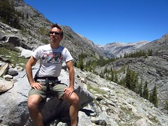
Got back last week from a very much needed backpacking trip in the California mountains. I was out in SF for a conference, and decided to stay a bit longer to see old friends and get some time out in the mountains, enjoying nature, and being offline (for more reasons why i love backpacking, see my honeymoon post). I was prepared to go solo, but was happy that my friend and old roomate Damian Spain could join me. I chose Goddard Canyon because it had plenty of water along the route, the trailhead was in a national forest (easier to get permits vs national parks or wilderness preserves), had a ferry, hot springs, and a waterfall, several options for camping (campgrounds are * on key points) and was below 10,000 feet so we could have campfires. We planned for 5 days, but on the fourth day we decided to hike extra and drive home that night. It was an amazing trip and would totally do it again.
Day 1: Drove 4 hrs from SF to Prather, CA (got permit), 2.5 more hrs to trailhead at Florence Lake. Hiked almost 8 miles to Muir Trail Ranch. Elevation from 0 to 7,700′
This was a busy day. We left SF at 7am, got permit around 11, had leisure lunch and drive to Florence lake, stopping by other dams and lakes, campgrounds, and ranger offices, arriving at the lake around 3. The ferry was not operational for the season yet, so we had to hike 3.4 miles more than we planned, putting us around the private ranch around sunset. We had trouble finding the campground by Blayney Hot Springs, so we just put up our tent along the jeep trail near the ranch. (Day 4 we found the campground, see below). If you arrive at night, another option would be to camp at one of the many car-camping campgrounds along the road about an hour from Florence lake. You can get a backcountry permit at a smaller High Sierra ranger office near Mono Hot Springs (map) the next morning, and have plenty of time to hike to the nice campground by the river and the hot springs.
Day 2: Hiked over 7 miles to the campground right passed the bridge 2 miles from the bridge marking Kings Canyon Boundary. Elevation from 7,700′ to 8,700′
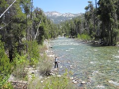
This was a much easier day then the previous day. We stopped because the campground was so nice – part shade, part sun, nice campfire ring, plenty of wood, 50 yards from river and a little off trail (but still very visible to hikers). One of the more interesting moments of the trip was when i stopped to fill up water in a small stagnant lake – a few leeches got on my water filter. There were always tons of large black ants around, so i decided to give the ants some lunch. Upon arriving at the campsite we took a nap and had a late afternoon campfire.
Day 3: Dayhike – Hiked about 10 miles up Goddard Canyon to see the falls, turned around before hitting Hell For Sure Pass. Elevation 8,700′ to 9,700′ back to 8,700′.
This was another easy day, we did it without packs and returned to the same campsite. Goddard Canyon was similar to what we had seen so far, just more granite and a more narrow canyon. The river was also a bit more interesting, having 5-10 feet granite walls in several places. The falls were impressive, but next time I’d like to try going up Evolution Canyon instead.
Day 4: Hiked 16-ish miles back to car. Elevation 8,700′ to 7,326′ (Florence Lake), drive back to SF.
By this point we had acclimated well to the elevation, so hiking was easy. We made it from our campsite to Blayney Hot Springs campsite by lunch time (over 7 miles). As it turns out, the campsite is right by the river, about a half mile from the main trail (just follow signs to Blayney Hot Springs). We found campfire rings but could not find the hot springs – later we figured out you must cross the river to the hot springs which lie in the meadow. At lunch we decided to cut the trip short and hike all the way back to the car and drive home. Damian said he had to be back to try on some dresses (or something like that). I actually had a blister on the bottom of my left foot so I was also down to finish off hike. We had an amazing time up to that point and I was completely satisfied. On the way home we stopped in Fresno for enchiladas, only Damian was too tired to read the entire menu and got something else instead. We arrived in SF about 2am thanks to D’s mad driving skills.
In summary we hiked about 40 miles, drove 13 hours, saw beautiful mountains, lakes, amazing trees, and animals, had time to relax, play with fire, get lots of exercise and fresh air, and had that reset button pushed hard. Can’t wait to make it to the Sierra Mountains again.
